As an Amazon Associate I earn from qualifying purchases.

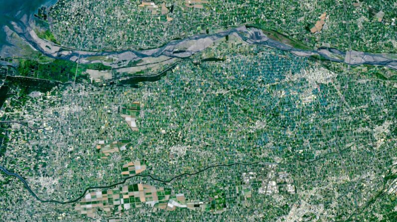
Where is it? Yunlin County, Chianan Plain, Taiwan [23.78563273, 120.44373747]
What’s in the image? A various colored ‘mosaic’ of little, securely compressed farms
Which satellite took the picture? Landsat 9
When was it taken? April 24, 2026
Learn more
As an Amazon Associate I earn from qualifying purchases.